19. The Nordic urban–rural typology:
Shedding new light on territorial differences
The Nordic urban–rural typology – which emerged as part of the Remote Work: Effects on Nordic People, Places And Planning project – was driven by the need for a territorial typology capable of shedding fresh light on how urban and rural areas should be categorised, particularly in terms of their development over time.
While regional- and municipal-level differences have been relatively well studied across the Nordic countries, a dearth of easily available, comparable, harmonised data means less is known about the demographic trends occurring at a more local level. With this in mind, the new typology aimed for a better understanding of such local-level differences and trends.
In practical terms, it was important to ensure the typology could combine different types of data, thereby providing a more nuanced understanding of territorial differences across the Nordic countries. The typology was created at a 1 x 1 km grid-level, allowing users to identify area characteristics at a fine-grained level.
The Finnish grid-based urban–rural classification (Kaupunki-maaseutuluokitus) provided the main source of inspiration for the new typology, with seven categories of Nordic territory identified based on the degree of urbanity/rurality: 1) urban areas; 2) outer urban areas; 3) peri-urban areas; 4) local centres in rural areas; 5) rural areas close to urban areas; 6) rural heartland areas; and 7) sparsely populated rural areas.
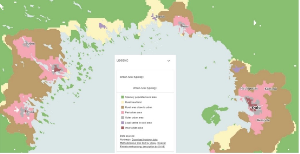
Visualisation of the interactive Nordic urban–rural typology web map, showing the cross-border Bothnian arc region in northern Finland and Sweden.
Dissemination and further use of the typology
The new Nordic typology has been launched as an interactive online web-mapping platform. This allows the user to zoom in on different areas across the Nordic countries, with the relevant typology data made available for downloading. The project also produced a report setting out the typology and detailing how it was constructed, accompanied by analyses of territorial differences, settlement patterns, and population change dynamics across the urban–rural continuum in the five Nordic countries.
Perhaps the most important benefit of the urban–rural typology is its ability to highlight territorial differences that may be unobservable using more generalised regional- or municipal-level statistics and data. For instance, the grid-based typology reveals that many municipalities feature urban, intermediate and rural areas. These territorial differences may be difficult to identify – or even be entirely concealed – at more general levels of aggregation.
While the new typology has thus far been used mainly for studying settlement patterns and population change dynamics, its flexibility is such that it can be used in combination with other types of data as an analytical framework for spatial phenomena across the urban–rural continuum. In fact, it has already been put to use in a number of research projects, including identifying cases study cities for the Nordic Climate Neutral Cities project; studying the location of airports based on their degree of urbanisation in the Electric Aviation project; and analysing migration patterns in the State of the Nordic Region 2024 report. The typology has also been used at the EU level, and is currently functioning as a point of departure for Nordregio in developing a European-wide typology for rural areas (as part of the EU-funded GRANULAR project).
Moreover, by providing an analytical tool capable of generating new evidence on territorial development, the typology can support spatial planning and policy. A concrete example of this can be found in Sweden’s Östergötland region, where the Nordic typology has been adapted by regional authorities and used in the regional strategy (see figure below).
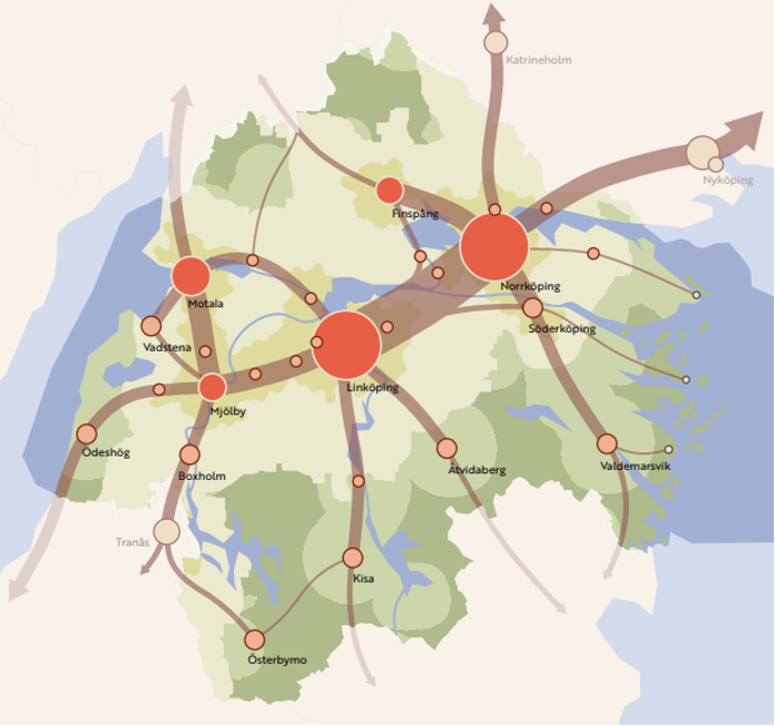
Photo: Unsplash